A must do when in Scotland is to hike Ben Nevis, the highest mountain in Scotland. When preparing for our trip I was searching for different kind of routes. I found quickly you have the main “Tourist track” and a few alternatives. The Tourist track is really crowded, certainly on days with good weather. But don’t let the name misled you, it won’t be a walk in the park. You still have to hike a couple of hours, all the way up and down.
We found the Carn Mor Dearg (CMD) route on UK Hill Walking, and we would like to highlight we would not redo this route. It was marvelous and a great experience and we got incredible views, but for us it was a bit too dangerous. So unless you are quite adventurous or experienced, we don’t recommend this hike. You also need to be in a good condition, as it should not be underestimated. Here follows the description of this route on UK Hill walking:
A contender for the title of grandest ridge walk in the country, the Carn Mor Dearg (CMD) Arete straddles that fine line between rambling and scrambling. This graceful curving line connects two four-thousand-footers, its blocky crest offering airy positions and stunning views of the cliffs of Ben Nevis, but minimal hands-on stuff. It is unquestionably the most enjoyable non-climber’s route on Ben Nevis, leagues ahead of the crowded and frankly dull trudge up the Tourist Track.
Statistics
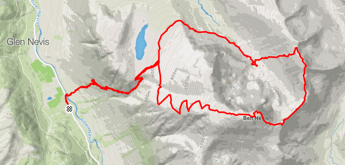
The whole walk, from and to the youth hostel, is about 19 km. We read it would take up to 10 hours, but mostly we are quicker than average. Elapsed time we did it in 7 hours 45 minutes which included just below 6 hours of real movement.
Leaving from Glen Nevis you have 2 options. First option is to leave from the parking lot at the visitor center. You will come across this one first. The distance is a bit longer, but the path is not that steep. The second option is leaving from the Youth hostel. Obviously that is shorter but steeper. We selected the second option.
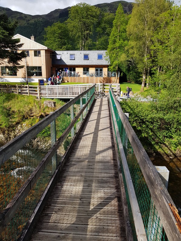
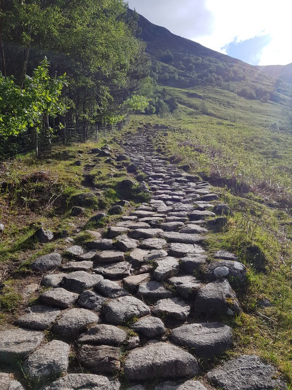
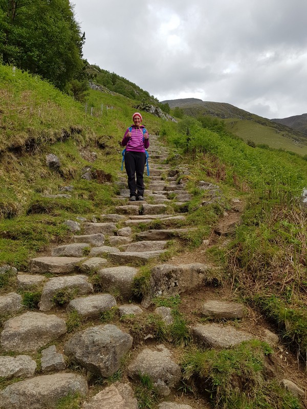
We parked near the youth hostel and there you have to cross a bridge over the river and then you follow the path up paved with stones. We saw this kind of created steps in Glencoe as well and we don’t like them. They are not high and short. In fact they are very easy to walk upwards, but I really dislike them going down. With bigger steps it gets a bit better, but it’s not our cup of tea 🙂
Bridge at youth hostel
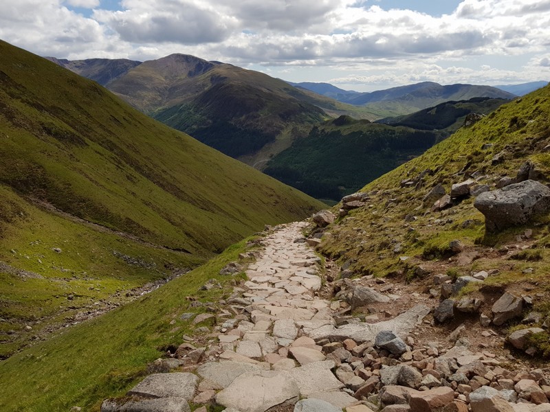
Path up towards junction
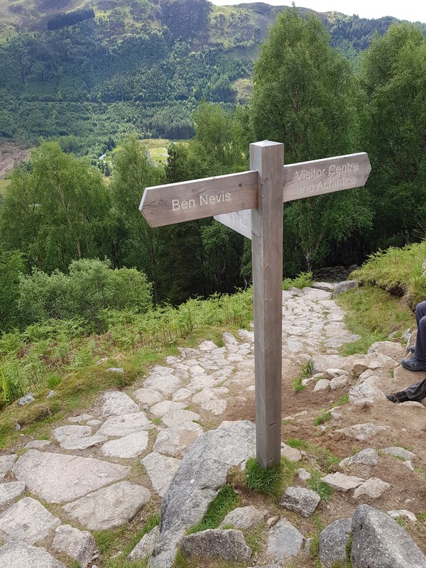
Junction sign
When you follow this path you will come to the junction with the trail from the parking lot of the visitor center, which is indicated with a clear sign. The first part was not really crowded, but as of this junction it was really busy. The steps are now more natural to take and few points are a little bit more tricky and there we even experienced some very small congestion. Make sure to look around and enjoy the views.
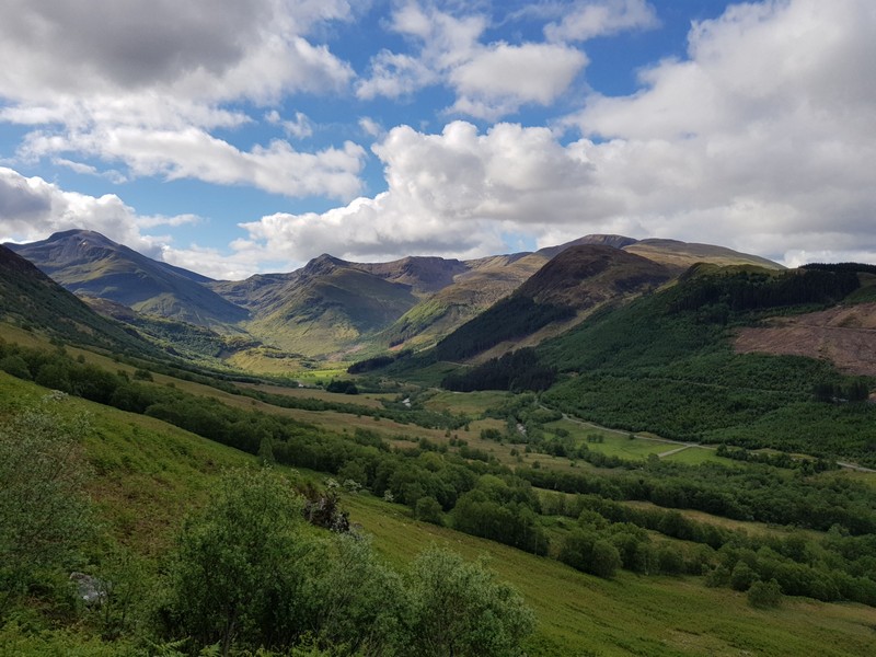
View on Glen Nevis Valley
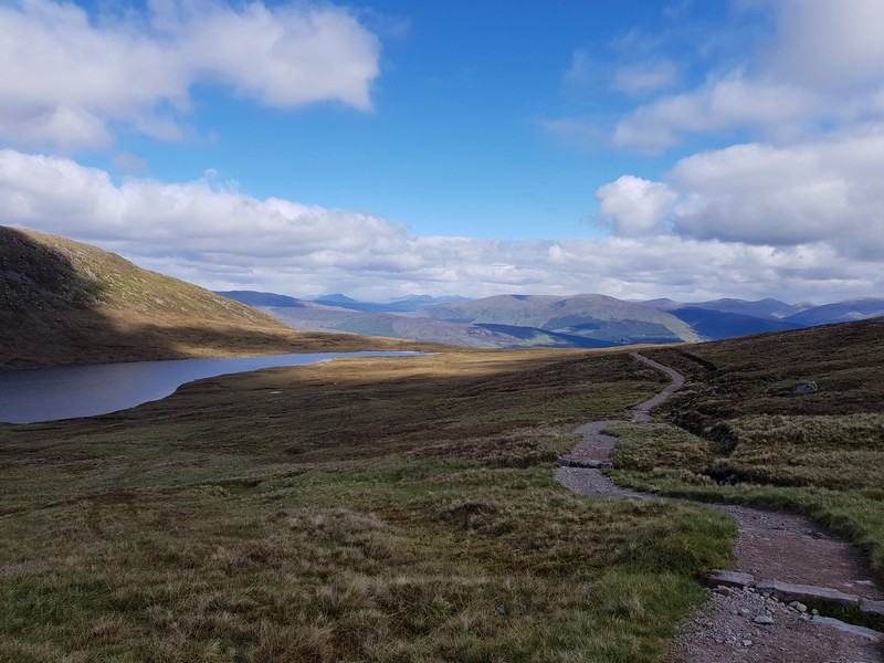
The path continues with mostly easy stairs and you will pass some zigzags before reaching a more flat part and here you will also see the ‘Halfway Lochan’ (Lochan Meall an t-Suidhe). It is here, when the tourist path takes a sharp bend to the right, that you will need to go left onto a newly engineered path. When you follow this for a couple of minutes the path will split and you have to take the right part. For us there was an arrow in stones to the right, but I wouldn’t count too much on that one. The left track goes in the direction of the lake, so don’t take that one.
View on 'Halfway Lochan'
Hiking path
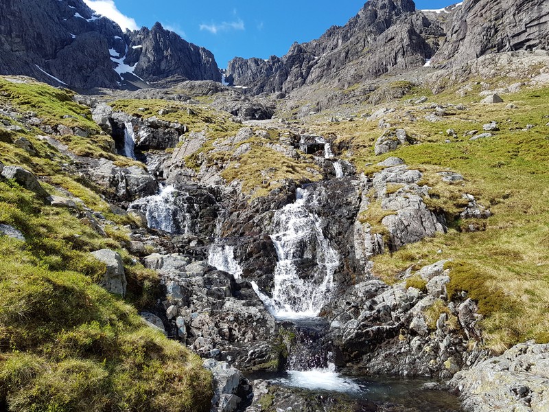
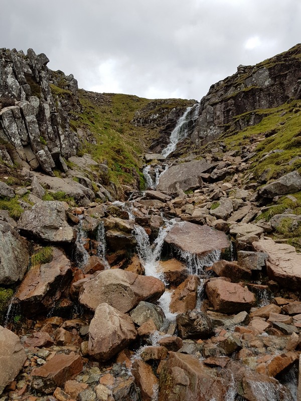
Waterfall halfway
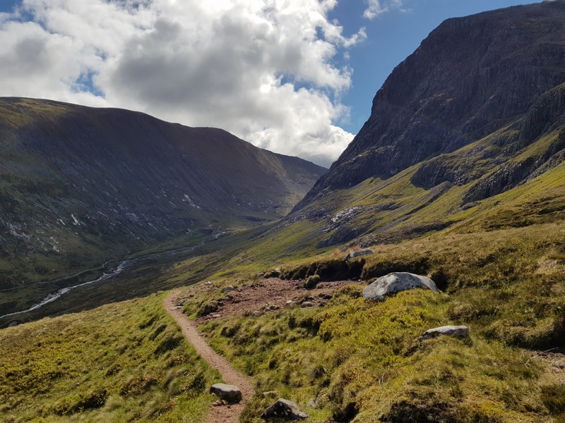
While following this path, which will even gently go down, you will come beneath the huge North Wall of Castle Ridge. You have to keep following this path and soon will notice the CIC Hut, which is not a public place. Just before this hut you have to cross the river and go to the left up the incredible steep wall and what follows is about 1.5 km climbing. This is not to be underestimated and you will have parts with incline up to 65%. It’s hard to find a path, and we had to find our own way It helps to take here and there the time to see where to go, to avoid water coming down, rocks, … It will feel as it never end, but don’t give up and just keep on climbing and enjoying the views. Remember, the only way is up!
During that climb you will have some more nice views on the incredible North Wall and also on the valley behind you.
North Wall of Castle Ridge
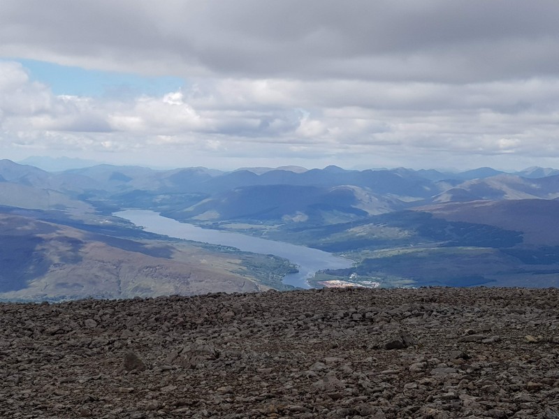
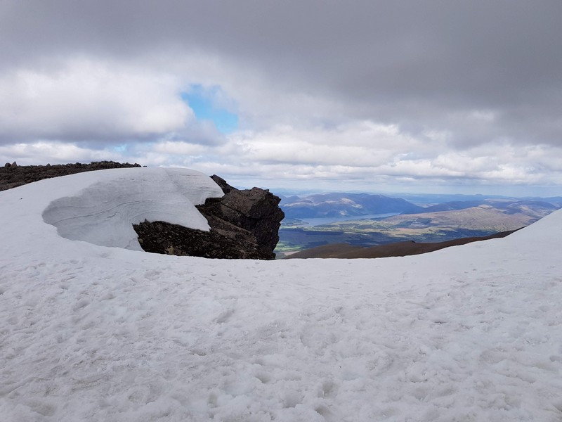
It will come as a relief when you reach the top of the steep wall, and only a little higher to the highest point where you will have a 360* view. Take a moment to enjoy this view, certainly on a nice day like ours. You have endless views. Also, you can see the top of the Ben Nevis, which you can’t see when you are on top of it 🙂
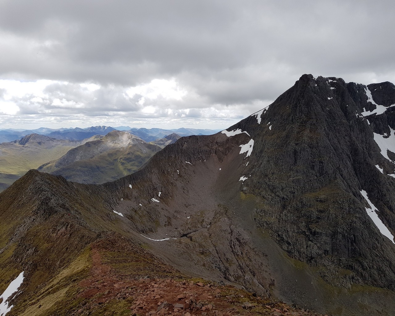
The ridge!
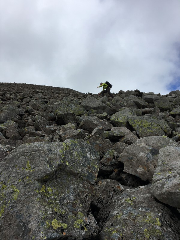
Now, where we thought the hard part would have been over after climbing that endless steep wall, it all had to start. You have to conquer a ridge of about 2 kilometers. This part is not to be underestimated. In a far distance we saw some tiny people on that ridge. We were in doubt to start that journey, but then again, turning back was also not an option, as that is against our nature. Marie-Claire, who is not in favor of heights was not very enthusiastic about this part to come, nor was Tom.
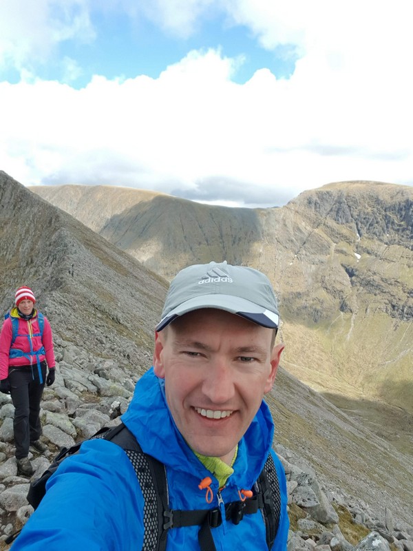
On the ridge you sometimes have a small kind of path, but often you have to climb over or next to rocks. Any mistake can turn out very badly as on both sides you would fall down over 400 meters. On the other hand, it is manageable, and we are proud we made it, but if we would have known, we would have maybe taken the ‘dull’ tourist route.
The ridge to conquer
Endless views
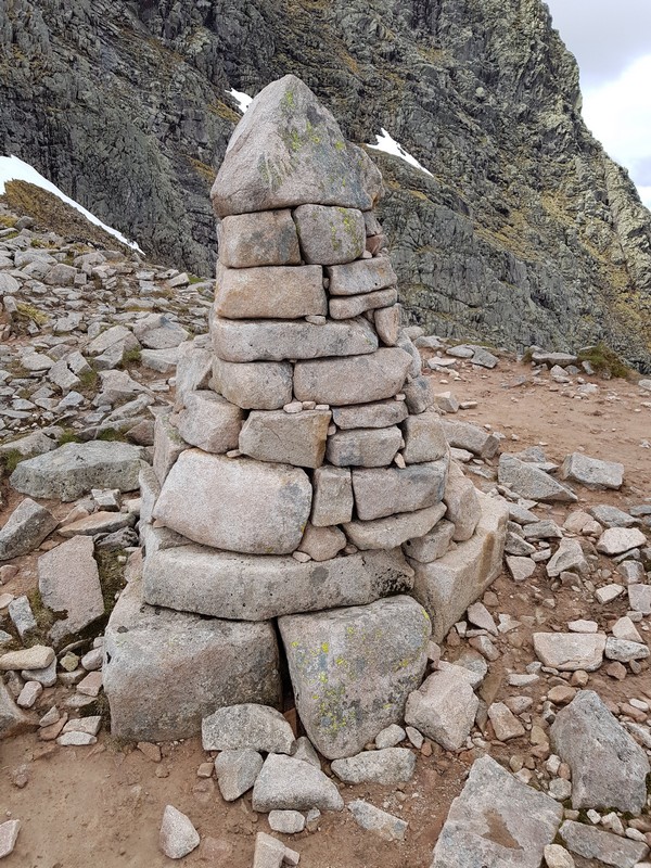
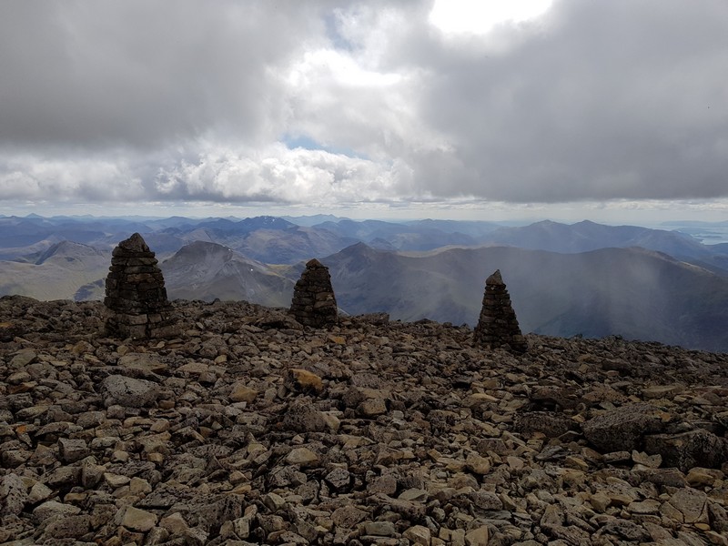
Pictures don’t reflect reallity, but on the picture below you get some impression how it was like walking on the ridge. This was an easier part, as else I wouldn’t take pictures 😉 When you reach the end of the ridge you will see some kind of small statue build with stones. It will be followed by a short easier part before you have to conquer the last obstacle of the climb, a steep wall of rocks. In fact, after the steep grass wall and the ridge, this was the hard part I enjoyed most, as the rocks climb quite well. And climbing is often easier than descending, as you can’t look down. In fact this wall of rocks was quite fun to do, but don’t underestimate it, it was yet again a quite intensive part of our journey.
Marie-Claire on the ridge
Before the rock wall
Rock wall of Ben Nevis
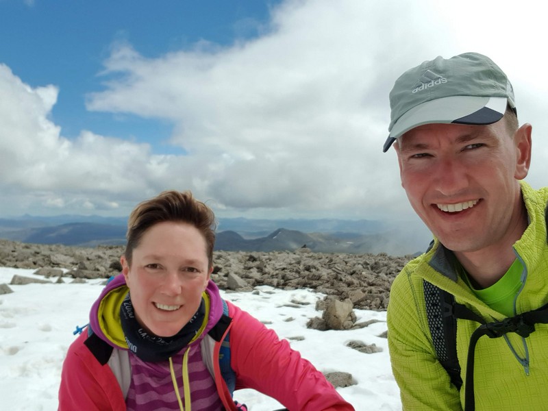
The summit
While climbing the steep wall with rocks, you see the ridge becoming smaller and smaller. And then, when ou don’t really expect it anymore you will reach the summit of Ben Nevis. You will reach the summit on the opposite site than the tourist track, so at first you don’t feel the crowd yet that much, but as you go more to the center of the top, you might be overwhelmed by the number of other tourists present. As we spent couple of hours almost alone, the feeling and experience is completely different.
Nevertheless, we had the feeling that already a lot of people left. When we started at 09:00 plenty of people were already going up and as our path took more time, we assume a lot of them were already down. Anyway, the top is big enough for plenty of people 🙂
On the top of Ben Nevis
We took the time to eat and drink something and watched a bit around, enjoying our experience. We already forgot about the scary moments on the ridge, and the awesome memory started to grow into our minds. After some some time we decided to move on, as the views we had before reaching the summit were better than the one on the summit of Ben Nevis.
Previous
Next
Back down
Is is not difficult to find the tourist path to go down. The rocks are worn down and you can also just follow the other people. When starting the descend you have some nice view on the valley when you have clear weather.
Going down will be hard for the knees. Certainly if you suffer at your knees like Tom. While going down we overtook plenty of people and we were surprised to see still people going up late afternoon. Certainly when we got lower and lower.
While going down on the tourist path, we were glad we took the Carn More Dearg to have had a loop. As we think it’s a bit dull to go up and down the same path. But mostly the crowd on the path is less enjoyable.
When the weather is bad, we would really discourage going up. Yes, you will have a hike, but being on the summit and not being able to see anything must be very pesky. We experienced that while reaching the summit on Isle of Arran (Goatfell). Off course, if you want to tick the box, go ahead, but satisfaction will be low according to us.
We were glad to reach our car and take of our hiking shoes. what a relief! Have some extra food and drinks and heading to the distillery of Ben Nevis to acquire some whiskey to celebrate our achievement 🙂
Waterfall
Less crowded
Almost down
Conclusion
What a walk! What a views! But we’ll leave it up to you if you select the tourist route or the Carn Mor Dearg route. We are sportive and adventurous but not mountaineers, so we would not do the hike again, as we did not always enjoy certain passage on the ridge. It was acceptible as the weather was great, but on a rainy day or with snow on the ridge, extreme care is needed. Off course, every person is different and according to some we might be exaggerating, but we are sure that for more than half of the people, it would be the absolute hell.


